Redefining Crop Scouting with AI & Drones
LenseAI
Autonomous Sensing for the Real World
Farmevo Technologies Inc. is a precision agriculture company that integrates the best of drone technology, multispectral imagery, photogrammetry, and AI to provide farmers with actionable insights to reduce input costs and emissions and increase yields.

Mission:
At Farmevo, our mission is to transform ag business and make it efficient, sustainable and profitable. Whether it’s through our high-resolution imaging for accurate plant health assessments or AI-driven analysis for optimized water and fertilizer usage, our services aim to drive the next wave of agricultural innovation.
Vision:
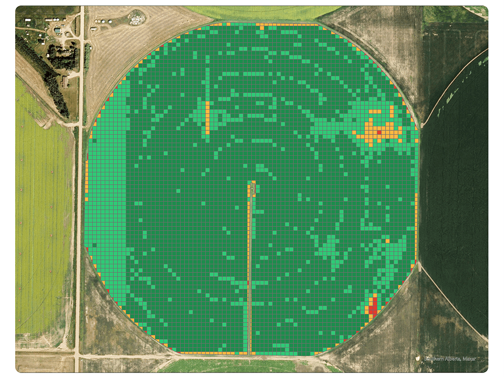
The goal is to increase the efficiency of collecting field-scale data and analyzing multiple layers of information to assist growers make profitable & sustainable decisions at their farms.
Redefining Crop Scouting with AI & Drones
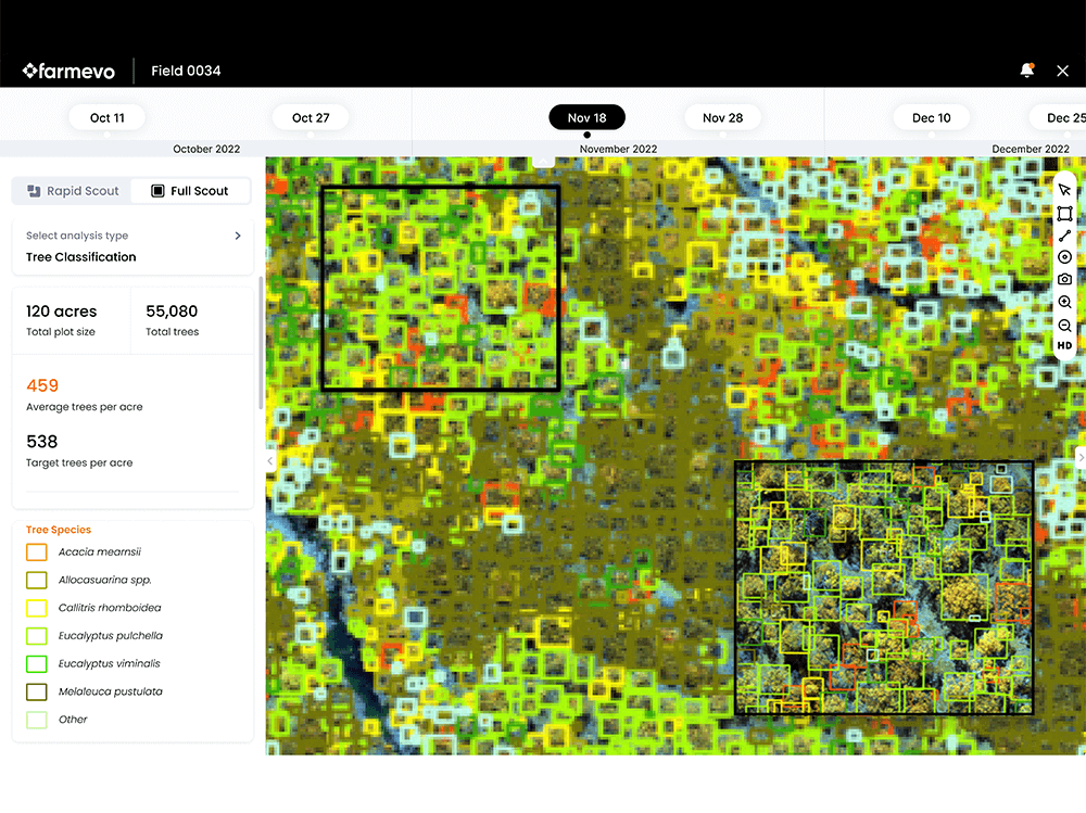
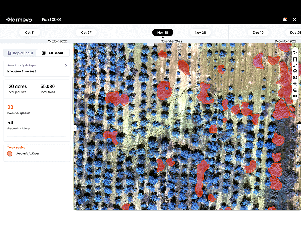
LenseAI powers autonomous crop scouting with drones, transforming high-resolution imagery into stand counts, crop health insights, and early yield signals — automatically and at scale.

Automated Drone Flights
Automated AI Reporting

Data Sharing

Unlimited Users & Farms

Historical Data Backup
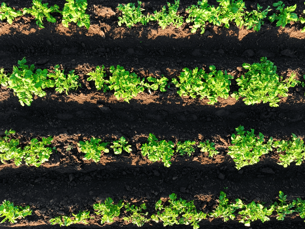
Snap Scout (Leaf-level images)

Reports & Outputs
High Res Map
Snap Scout (Leaf-Level Images)
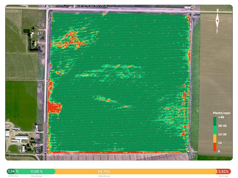
Crop Health Map
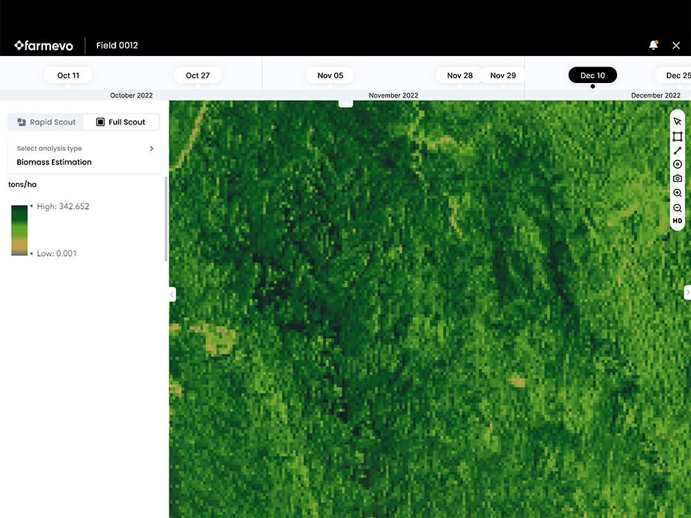
Bio Mass Estimation
Variable Rate Application
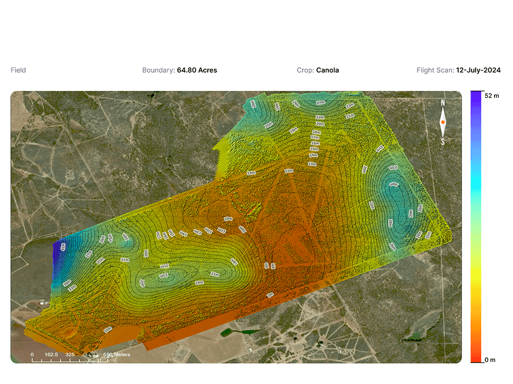
Elevation Map
Drainage Map
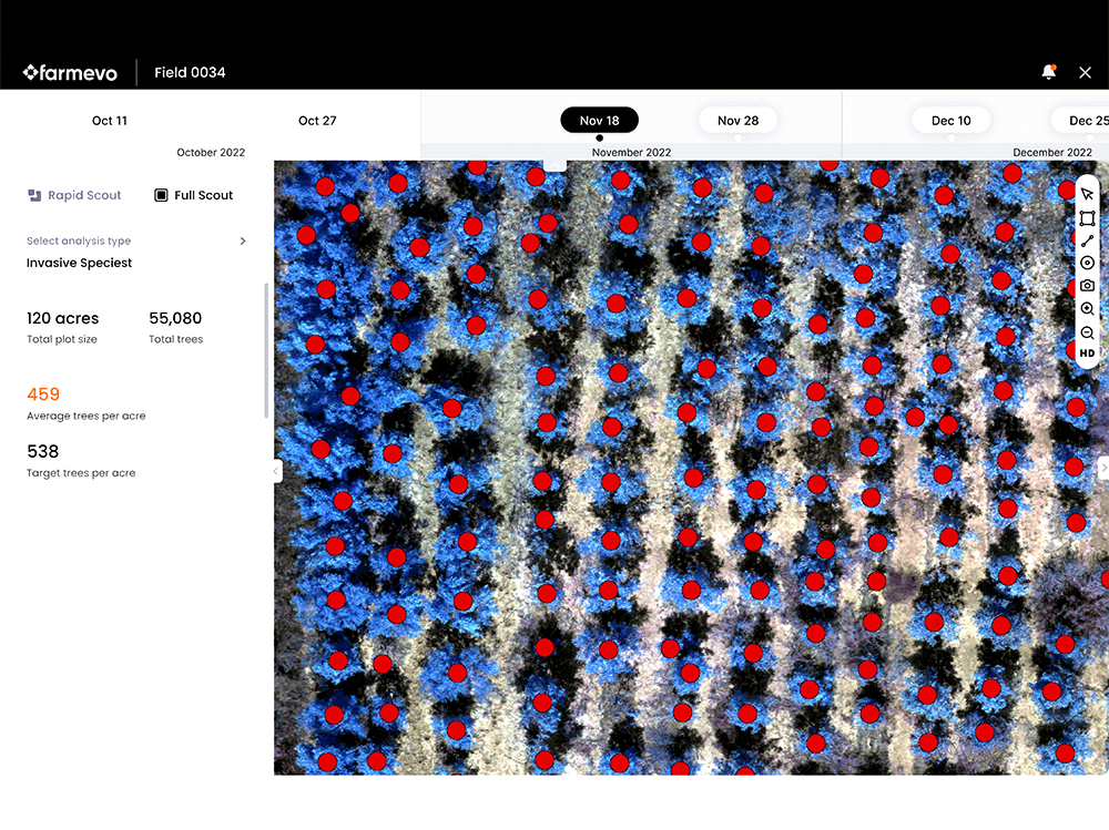
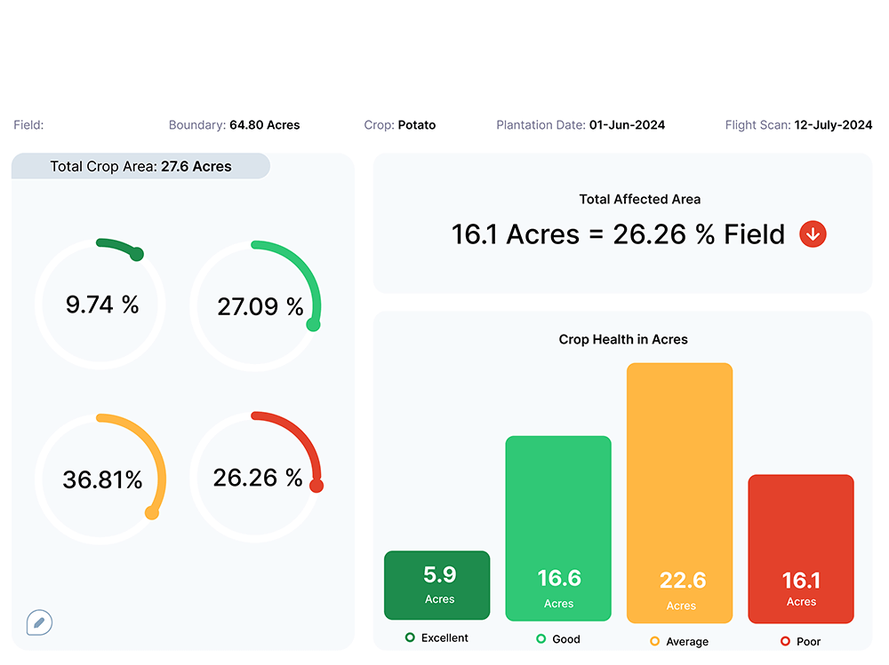
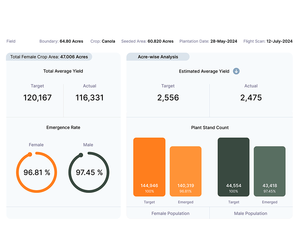
Plant Stand Count
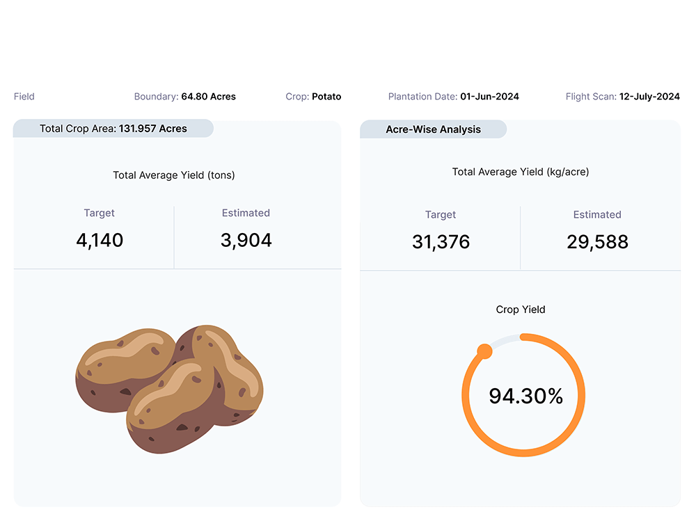
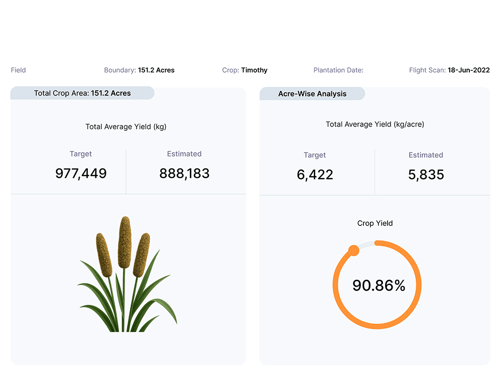
Yield Estimation
Anomaly Detection
Spot Application
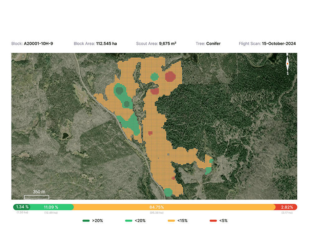
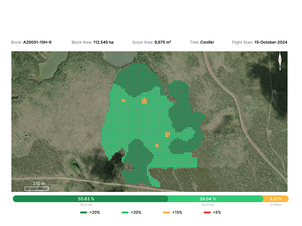
Forestry Intelligence made accessible & affordable
Farmevo enables forestry teams to augment manual surveys with automated drone surveys, delivering 3–5x quicker insights, higher accuracy, and consistent reporting at scale.
From Flight to Insight in 5 Clicks

Import Block Boundaries

Capture Drone Data Anonymously

View Insights on Web Portal in 12 Hrs
Our Capabilities
Recce Survey
High Resolution RGB Map
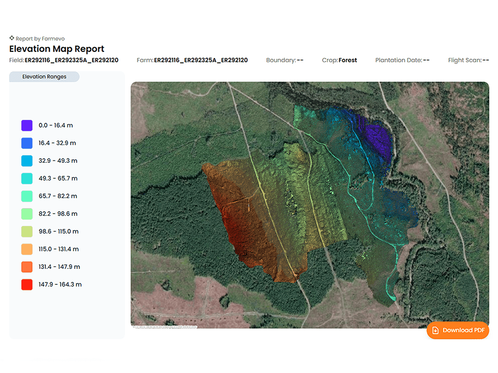
Elevation Map
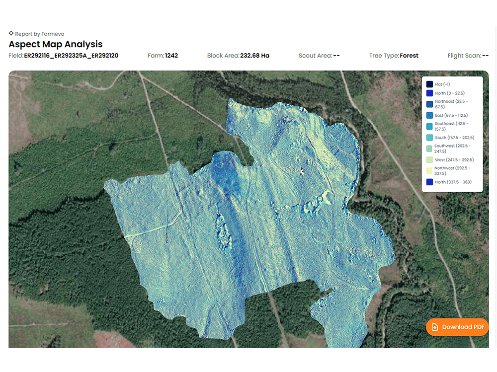
Aspect Map
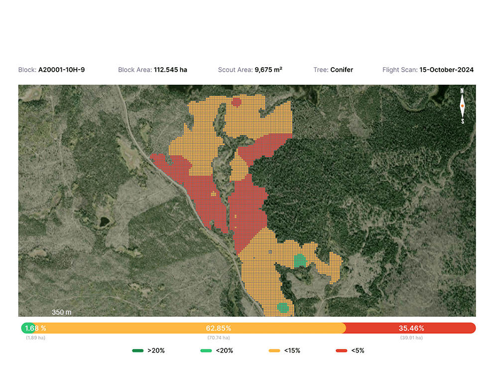
Void Map
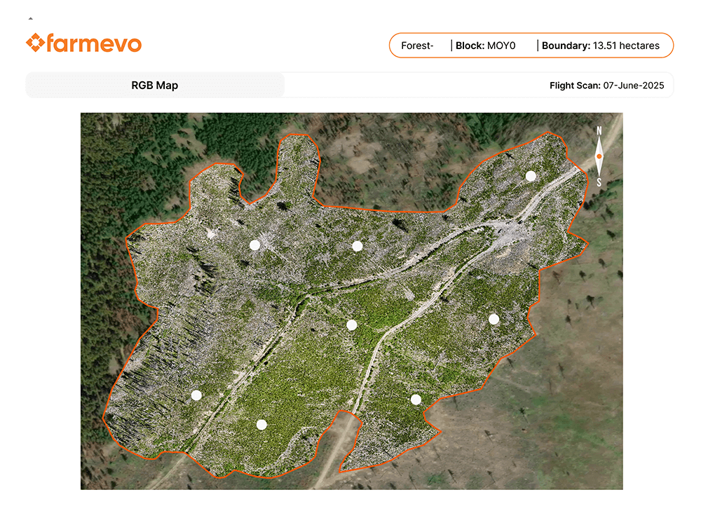
Plot Level Surveys
Stems Per Hectare
Crown Closure
Tree Height
Well-Spaced Tree Count
Species Detection